
RPM Geospatial
Atlantic Canada’s Leading Geospatial Data Company
Trust the Experts in Geospatial Data Collection
At RPM Geospatial, we’re committed to providing our clients with exceptional geospatial/geophysical data by leveraging the latest surveying and sensor technology. This commitment to technical excellence unlocks critical insights and solutions for our clients’ most important projects, providing them with measurable, dependable data with unparalleled accuracy. From detailed land surveys using LiDAR technology, comprehensive infrastructure inspections, or magnetometer surveys, we deliver crucial data for industries ranging from construction and engineering to environmental conservation and mineral exploration.
Our Mission
Our mission is straightforward: to empower our clients with the most accurate and actionable geospatial and geophysical data, utilizing cutting-edge technology and expertise to solve complex problems and drive client success.
Customization
Suitable for a wide range of applications, from topographic mapping and forestry management to urban planning and infrastructure projects.
Accuracy
Our technology produces highly accurate data, even in complex environments like densely forested areas or urban landscapes.
Efficiency
With the ability to cover large areas quickly and significantly reduce the time needed for surveying tasks compared to traditional methods.
Over
Hectares Covered
Over
Data Points Collected
Our Services
Ready to Elevate Your Project?
Discover how RPM Geospatial can bring your project to new heights. Explore our services to learn more about what we offer or contact us today to discuss your specific needs with our experienced team. Let us elevate your project by blending the world’s best technology with our expert operators to achieve outstanding results.

Geospatial
- Topographic Surveys
- Dimensional Surveying
- Mobile Mapping
- 3D City & Infrastructure Modeling
- Measured Building Surveys
- As-Built Surveys
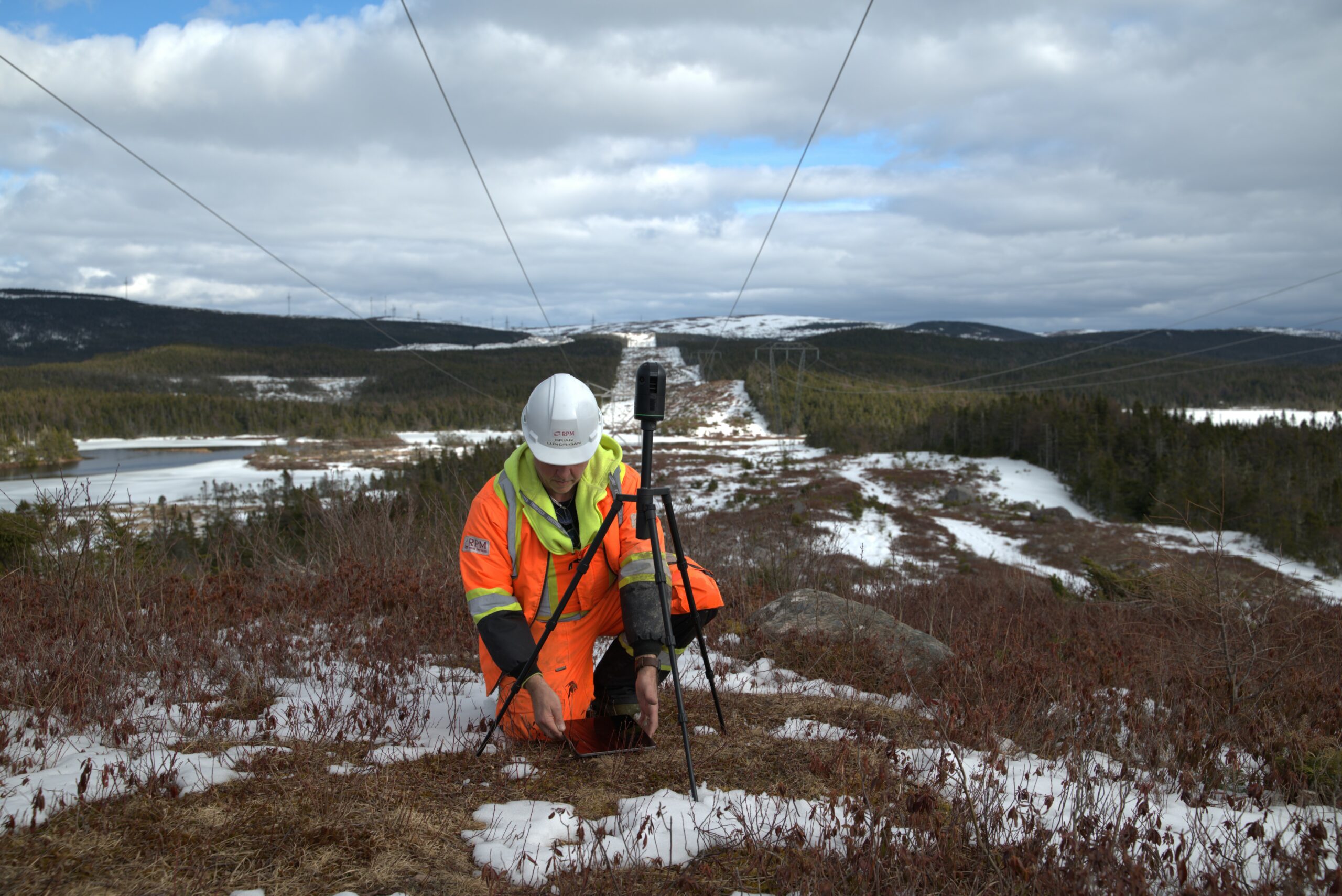
- Powerline Clearance Surveys
- Underground Mapping / Modeling

Geophysics
- Magnetometer Surveys
- VLF Surveys
Other Services
- Offshore Operations
- Water Leak Detection
- Buried Infrastructure Detection
- Ground Anomaly Detection
Why Choose RPM Geospatial?
Advanced Technologies
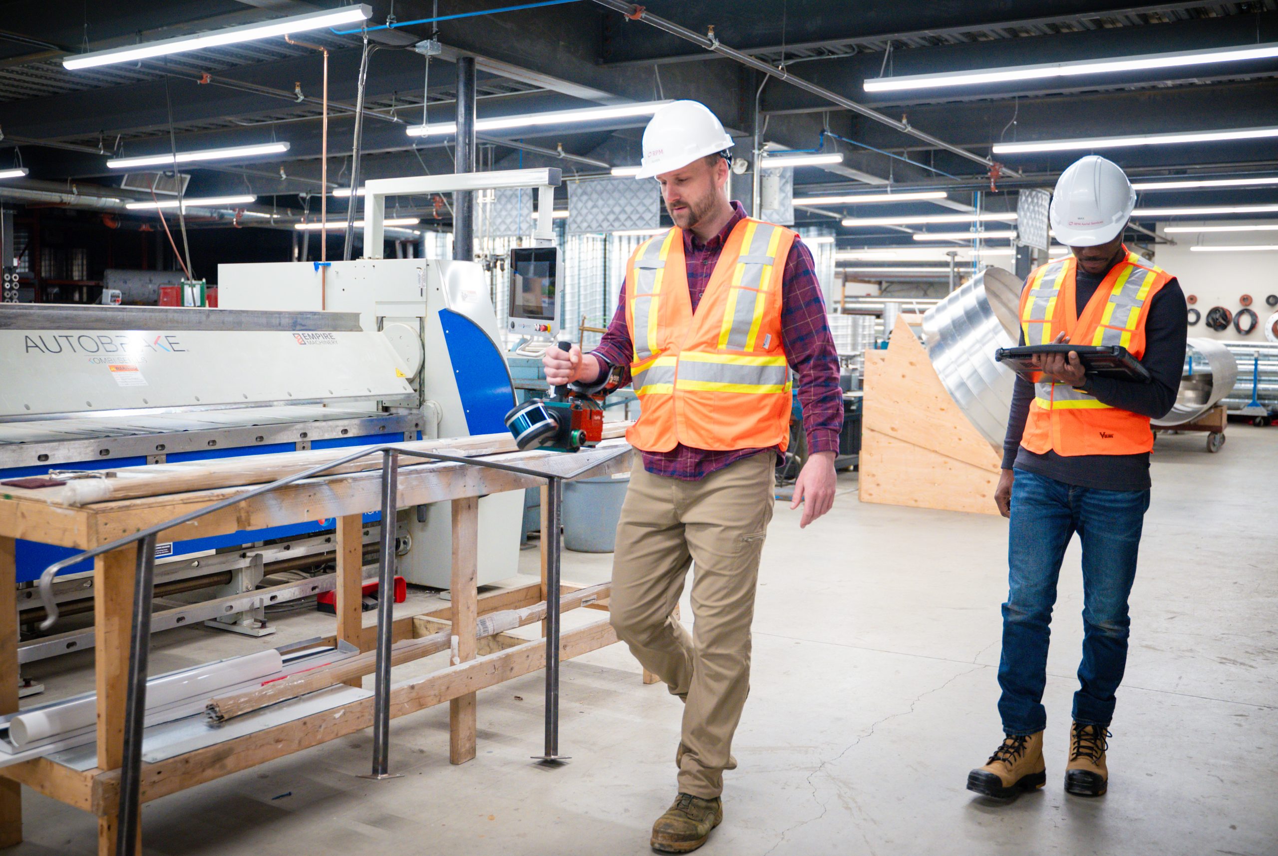
Our industry-leading solutions are delivered through a wide range of surveying methods, including LiDAR, 360 Photo/Video, Magnetometry, and more. We can avail of our arsenal of in-house technology to not only enhance your project, but also deliver data in a format that is agile and easy for our clients to navigate.
Expert Team
Our experts bring a wealth of knowledge and experience in Geospatial and Geophysical surveying, ensuring that you get exactly what you need for your project. And our experienced team, combined with our strategic partners offer access to world class technologies and expertise.
Customized Solutions
We understand that each project is unique and RPM Geospatial will work closely with you to develop customized solutions that address your specific challenges and goals. No matter the challenge, RPM Geospatial has the solution!
Commitment to Safety and Compliance
We prioritize safety and regulatory compliance in all our operations, ensuring that our practices meet the highest industry standards. RPM Geospatial is COR certified and completes every job by the book, safely and professionally.
On-Time & On-Budget
RPM understands and respects the need for precise project planning and budgeting. Just as important is the need for contractors to bid cost-effectively and responsibly so projects remain on time and on budget. At RPM, we pride ourselves on quoting projects accurately and responsibly with a 99% accuracy rate in delivering projects on time, and within quoted budgets!
RPM does not believe in, nor participate in “Cost Plus” quoting!

Calibre Mining Corp
RPM has been a frequent supplier of Geospatial and Geophysical surveys for our projects, not only providing timely and excellent service, but always executing projects on time and on budget. Having a supplier that can quote projects accurately and avoid cost overruns has been essential to managing our project budgets.
Nicholas Capps | Senior Exploration Manager at Valentine Gold Mine

Exploits Discovery Corp
RPM has remained Exploits’ preferred supplier of airborne Geospatial and Geophysical surveys since September 2022. RPM’s skilled and enthused team has consistently provided us with diligent, real-time service at a variety of exploration sites within central Newfoundland. RPM has completed all their assignments with safety, and cost-effectiveness at the forefront – I have 100% confidence in their data-quality and capabilities of delivering the final product to us on-time and on-budget.
Ken Tylee | VP of Exploration, Exploits Discovery
Trusted By


Our Committment
RPM Geospatial is dedicated to providing superior geospatial and geophysical data, setting the standard in Atlantic Canada for excellence. By integrating the latest technological advancements, we ensure our services not only meet but exceed expectations. Our commitment to quality is evident in every project we undertake, driven by our passion for innovation and excellence. The heart of our operation lies in our ability to stay ahead, constantly updating our practices and tools to remain at the forefront of the industry. This relentless pursuit of perfection is what makes us leaders in our field.
Safety and precision guide every aspect of our work at RPM Geospatial. We prioritize the well-being of our team and the integrity of our projects, adopting practices that surpass industry safety standards. Customization is key to our approach; we believe that every project has its unique challenges and requires tailored solutions. Our team is skilled in adapting our wide range of services to fit the exact needs of each client, ensuring effective and efficient outcomes. Through this flexible methodology, we’re able to tackle any project, regardless of its size or complexity.
Building meaningful, lasting partnerships with our clients is at the core of what we do. We view our clients not just as customers, but as partners in a collaborative effort to achieve success. Our approach is rooted in trust, transparency, and a deep commitment to supporting our clients’ goals. By listening closely and providing expert advice, we forge relationships built on mutual respect and shared achievement. It’s this foundation of trust and collaboration that enables us to deliver results that truly make a difference.


Our Technology
At RPM Geospatial, we harness a broad array of advanced technologies to deliver superior geophysical and geospatial solutions. Our state-of-the-art toolkit, including various LiDAR technologies, a range of Geophysics equipment, and high-end 360 camera technologies, and sets the standard for precision and reliability. These tools empower us to serve a wide range of industries with data that’s not just accurate but also actionable. Whether modeling inside buildings, mapping roads & communities in intricate detail or exploring below ground, our technology captures the critical information our clients need.
Our commitment to technological excellence means we’re constantly evolving, integrating the latest advancements to stay at the forefront of the geospatial and geophysical fields. This forward-looking approach allows us to tackle projects of any scale and complexity, delivering results that truly make a difference. With RPM Geospatial, clients across multiple sectors benefit from cutting-edge solutions tailored to their specific challenges, ensuring they always stay one step ahead.
Careers
At RPM Geospatial, we are continually seeking to expand our team with highly skilled professionals who are not only passionate about geospatial and geophysical data but the creation or integration of new technologies, systems or techniques that will provide better solutions for complex problems.
While we may not be actively advertising for a position, we welcome the interest of talented individuals in the following areas:
- RPAS/Drone Piloting
- Data collection & Processing
- Geographic Information Systems (GIS)
- Surveying, and
- Advanced Data Management Techniques
If you believe your skills and expertise can enhance our dynamic team, we encourage you to reach out and join us in finding solutions today for tomorrows problems!