
RPM GEOSPATIAL SERVICES
Geospatial
RPM Geospatial offers comprehensive surveying solutions tailored to meet the diverse needs of our clients, guaranteeing the most precise, efficient and versatile solution for every situation.
Topographic Surveys
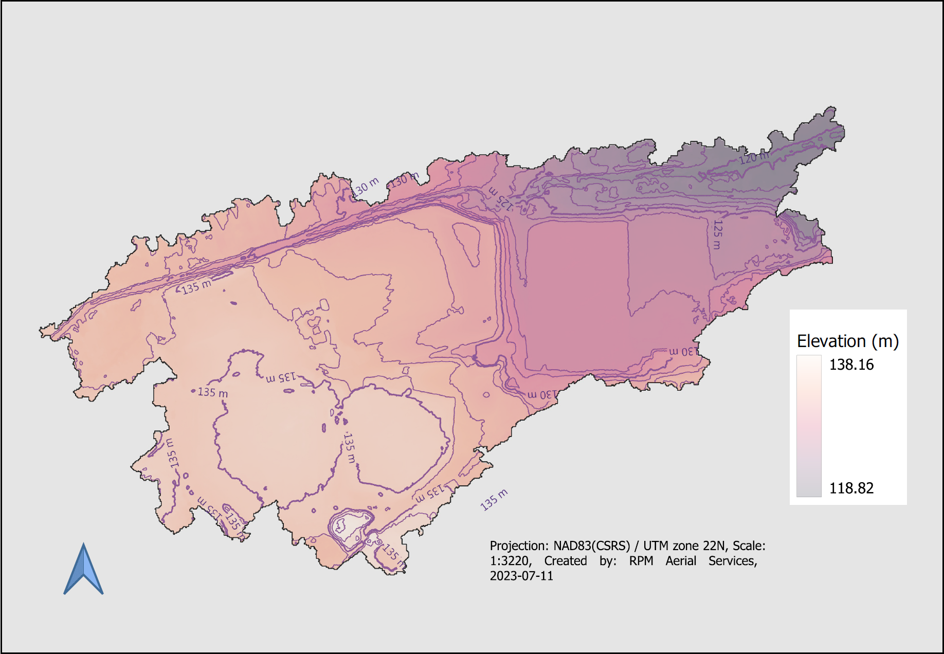
RPM Geospatial works with professionals across a wide variety of sectors, including architects, engineers, and contractors. Providing services for both large and small-scale construction and engineering projects, as well as for land development and transportation infrastructure mapping. No matter the scale of your project, RPM Geospatial is the company of choice for your topographic surveys.
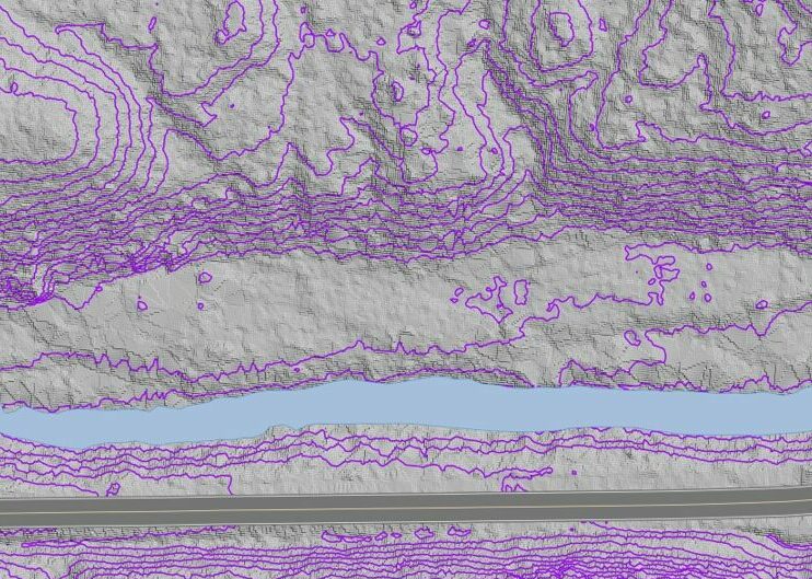
A topographic survey is often required for design purposes, including new construction and improvements and upgrades for industrial, commercial, and residential applications. A well-defined topographic plan will help guide architects, engineers, and contractors in the planning and construction phases.
Normally completed at the start of a project, a topographical survey typically includes measurements of features including structures such as roads, buildings, communications, and utility towers. In addition to these features, RPM Geospatial can also collect terrain features such as trees, rivers, streams, and hillsides. RPM Geospatial can create a variety of deliverables including “bare earth models” to show you exactly what terrain lies underneath vegetated areas.
Dimensional Surveying
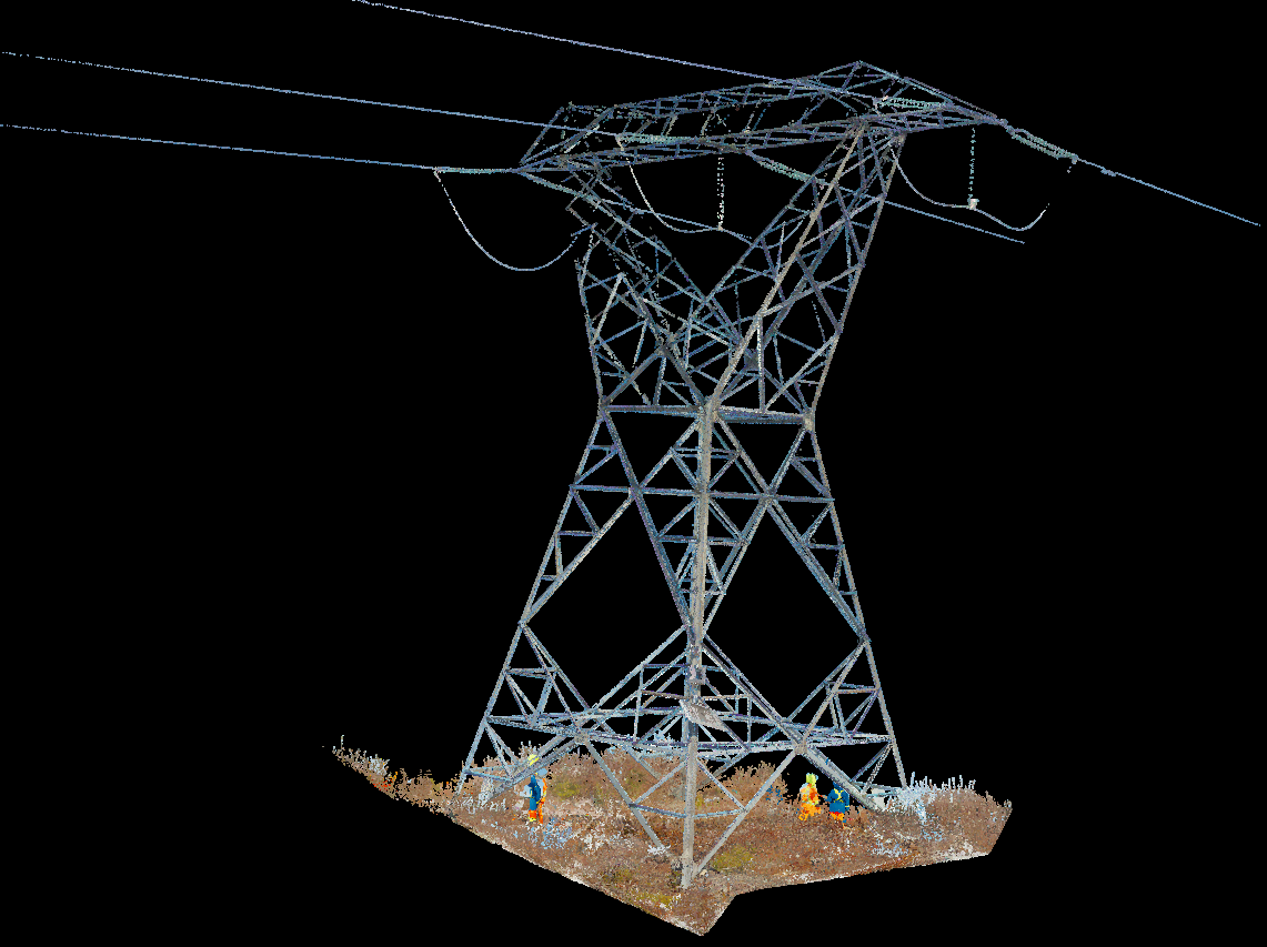
RPM Geospatial offers a range of dimensional surveying services, including 3D laser scanning, and as-built modeling. These services are valuable for many industries including construction, engineering, and architecture.
This technology has been around for decades and is generally known as the science whereby three-dimensional spaces are accurately measured to determine the area between points, creating digitally mapped distances and angles.
Dimensional control survey is very well suited for industrial measurement, 3D capture, replacement pipe-work, mining surveys, structural steel surveys, structural monitoring, and fabrication surveys.

Mobile Mapping
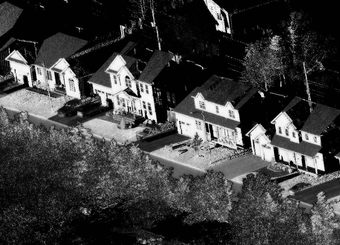
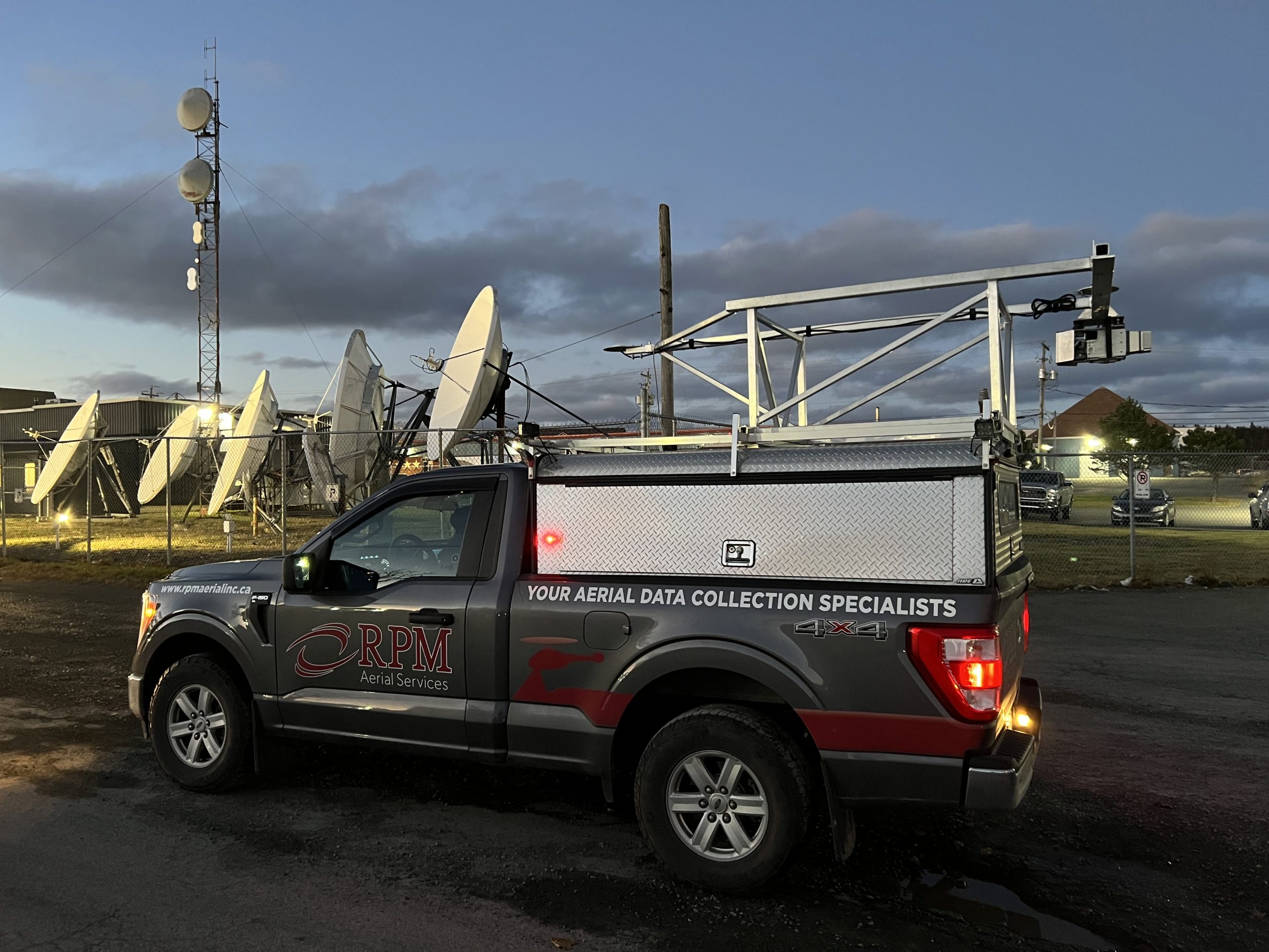
RPM Geospatial utilizes a variety of collection methods to provide you with the highest quality geospatial data in the industry. In keeping with its commitment to leading the industry with cutting edge technologies, RPM Geospatial offers mobile mapping, a vehicle-based LiDAR and 360 Camera-based collection system capable of traveling and capturing roadways at highway speeds. Our systems also thrive in GPS denied environments, collecting robust data in and around bridges, or in densely populated areas with tall buildings.
RPM Geospatial utilizes the most advanced technology in the industry, allowing for the efficient capture of geographic information such as roads, buildings, and landscapes, and can be used for applications like navigation, urban planning, road construction and upgrading, and asset management. Mobile mapping has a wide range of uses, from aiding in disaster response to supporting infrastructure development and municipal management.
3D City & Infrastructure Modeling
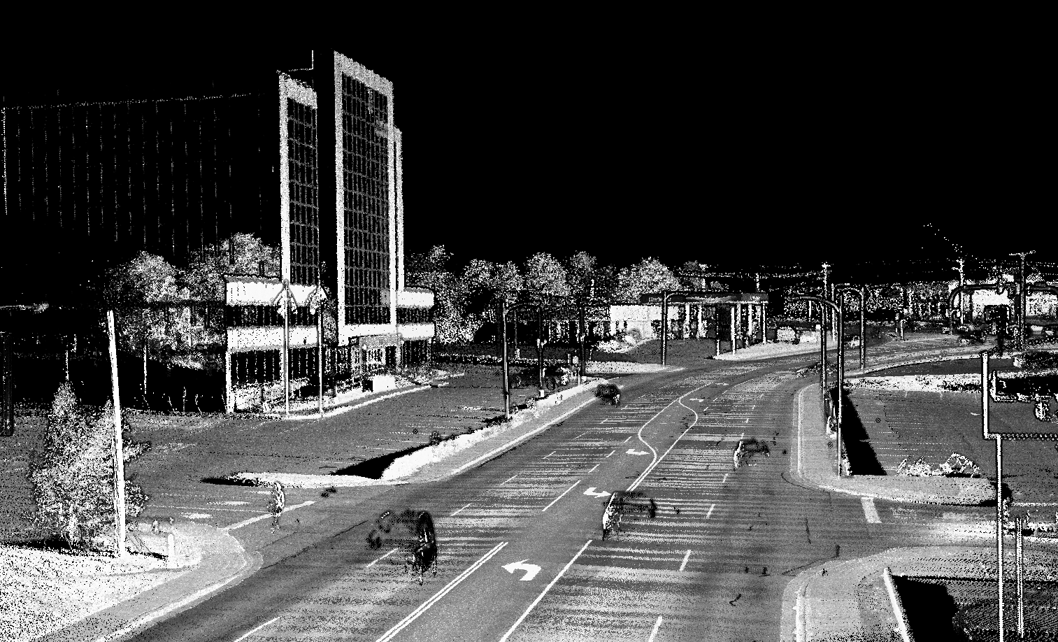
Looking to capture every nuance of your municipality and integrate asset management into the picture? RPM Geospatial has you covered. Let us collect highly detailed LiDAR-based survey data to allow your team to manage your municipality from the comfort of their desk. RPM Geospatial has a highly skilled team of data processors who will class out any and all infrastructure you require such as fire hydrants, curbs, and culverts to name a few.
RPM Geospatial also works closely with engineering firms, and utilities to scan other types of infrastructure including but not limited to substations and switchyards. Not only using the latest land-based technology, but we can also employ the services of our sister company RPM Aerial to utilize aerial systems and techniques to provide you with digital twins of large exterior areas, you with robust and accurate models.
Measured Building Surveys
Measured building surveys are an accurate depiction of a building which illustrates all structural elements and architectural features. A measured building survey can show multiple elements including, but not limited to:
- External surveys show the façade of a building including window positions, guttering and walkways, slopes, and decorative features.
- Internal surveys show precise measurements of doors, walls, beams, and windows down to any exposed HVAC, electrical or plumbing/piping.
Surveys can recreate accurate floor plans of any floor in any building. When a building has been upgraded over time, or in cases where companies do not have any drawings of buildings or infrastructure, Measured Building Surveys are the answer.

As-Built Surveys
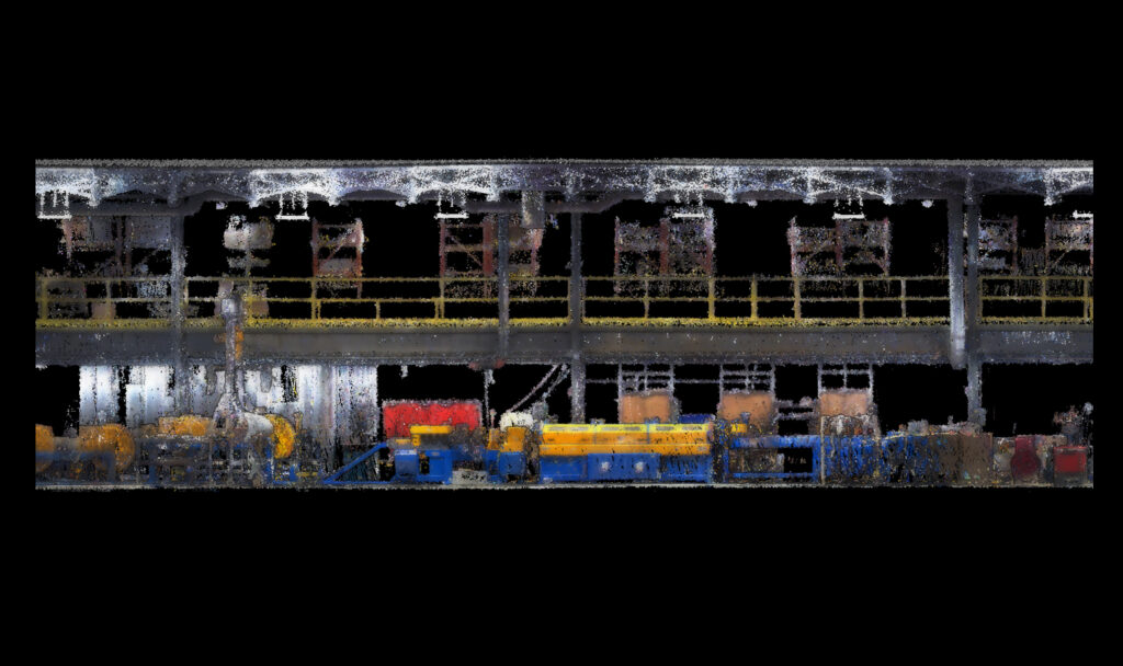
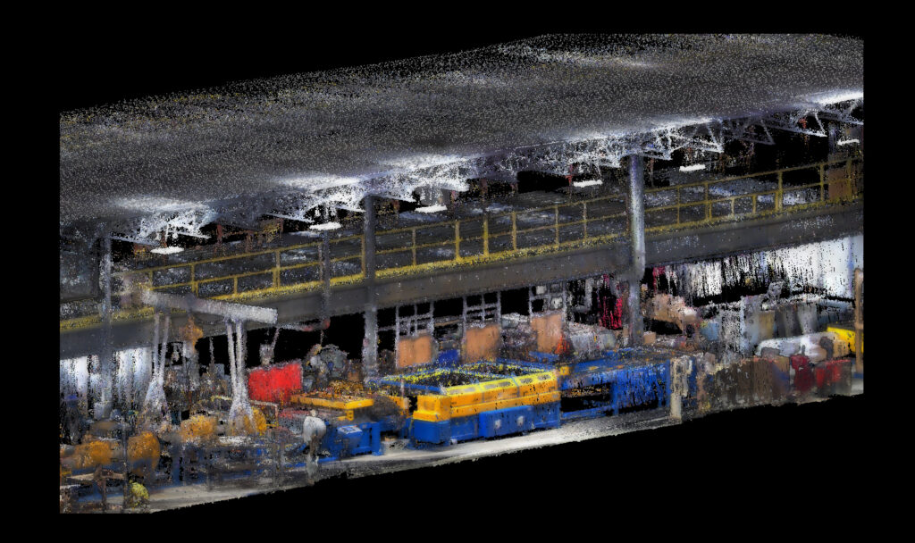
An As-Built survey is a geometric undertaking conducted on a road, building or other infrastructure, and can be done both during and after construction is complete. At RPM Geospatial, we can produce highly accurate 3D models that detail the project at a precise moment in time. An As-Built survey may also be used to verify, through the As-Built drawings, the correlation between the approved project and what was built.
In general, an As-Built model shows the exact position of the structural, mechanical, electrical, and architectural elements of buildings, or elements of roadways to be upgraded, the completion of new road construction projects, and to provide a complete picture of the project at the time of the survey.
The process of creating an As-Built model starts with an advanced geometric LiDAR survey of the infrastructure to be modeled. The collection of this data may utilize multiple methods including Mobile-Mapping, Hand-Held LiDAR systems, Tripod-based LiDAR systems, and traditional survey techniques, as well as various aerial technologies.
The combined services of RPM Geospatial, and its sister company RPM Aerial can bring to bare a comprehensive suite of technologies to complete all your As-Built survey needs.

Power Line Clearance Surveys
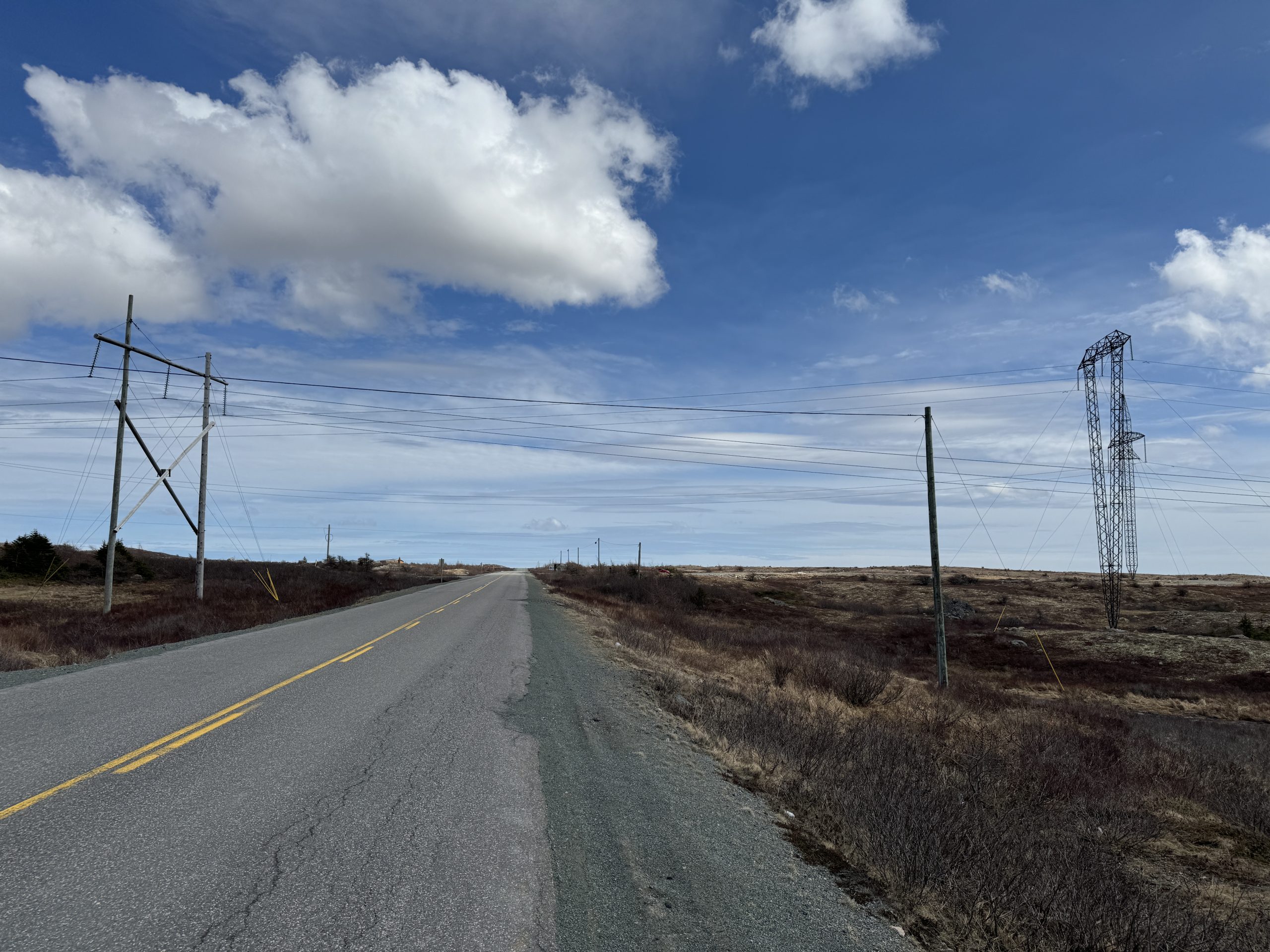
The nature of power transmission and distribution, combined with sprawling road networks and ongoing development often conflict at areas of intersection, and the requirement to maintain safe clearances can be challenging.
Whether moving large equipment along urban or rural roadways, or when planning new road construction that may cross under existing powerlines, measuring, and maintaining safe clearances are critical.
RPM Geospatial offers a variety of methods to model key sections of power corridors to ensure safety is maintained every step of the way.

Underground Infrastructure Mapping
RPM Geospatial can map your GPS/GNSS denied underground environments utilizing various LiDAR based mapping technologies. These technologies can include the use of tripod and/or hand-held/backpackable LiDAR based technologies, traditional survey techniques or fully autonomous aerial systems as provided by RPM Geospatial sister company, RPM Aerial. This suite of technologies is perfect for modeling underground mines, and critical infrastructure such as electrical systems and ventilation, or for modeling hydro powered system such as large penstocks and caves. Your staff will be able to access important data via the comfort of their desk, increasing safety and efficiency.
Let RPM Geospatial capture your data with accuracy and precision, enabling you to run your operation safely and effectively.
