

Highway projects often extend over long distances and complex terrain, where conventional survey coverage can be slow, disruptive, hazardous, and costly, especially when crews need time in or near live traffic.
For existing corridors, RPM streamlines data collection using LiDAR-based Mobile Mapping to capture continuous, corridor-wide geometry, including embankments and surface features at speed. This approach reduces exposure in traffic that limits lane impacts. The result: a dense, design-ready dataset supporting grading, drainage, and tie-ins without relying on interpolations between traditional survey shots.
Where wider-area context is needed, such as interchanges, adjacent terrain, or broader drainage features, RPM can complement mobile mapping with aerial LiDAR and photogrammetry, and handheld/backpackable LiDAR to fill gaps and extend coverage beyond the roadway.
How RPM Supports Highway Projects:
-
Mobile LiDAR corridor mapping for continuous existing-conditions capture along live roadways
-
Contours and surface models for grading design, drainage analysis, and roadway tie-ins
-
Mapping roadside infrastructure including shoulders, ditches, guardrails, signage, linework and safety features
-
Capturing bridges, interchanges, access points, and constrained geometry along the corridor
-
Reduced field exposure by minimizing time spent on-foot in traffic environments
-
Aerial LiDAR and photogrammetry to extend coverage beyond the corridor where needed (terrain, context)
-
Design-ready deliverables compatible with CAD, GIS, and BIM workflows
Mobile Mapping
To support existing corridor
mapping across infrastructure networks, our patent-pending
mobile mapping system can rapidly capture terrain, assets, and surface conditions far faster than conventional RTK or total station methods while collecting
significantly denser spatial data.
This approach enables existing conditions and corridor features to be documented efficiently while maintaining the level of accuracy required for planning, assessment, and engineering workflows.
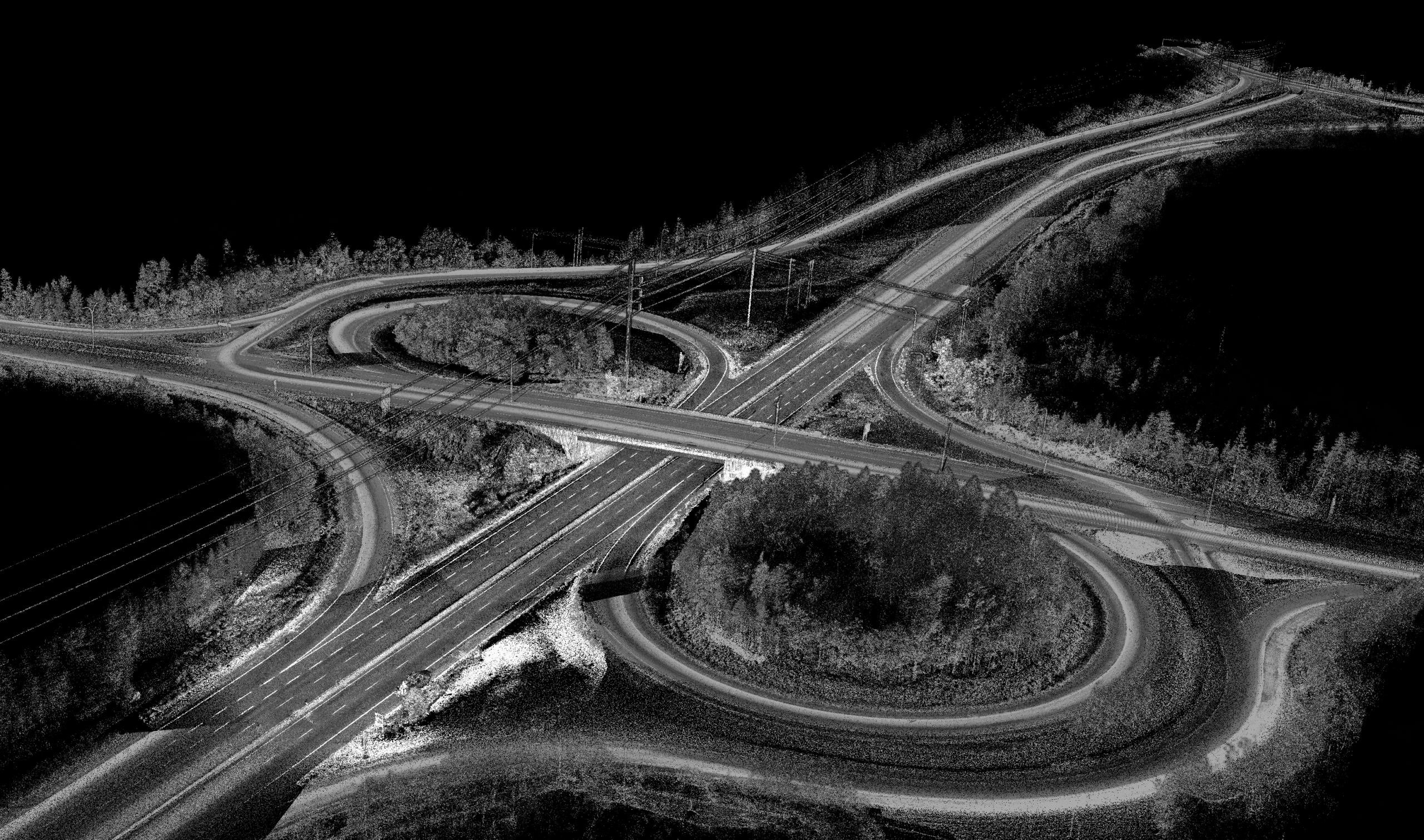
Mobile Mapping (LiDAR)
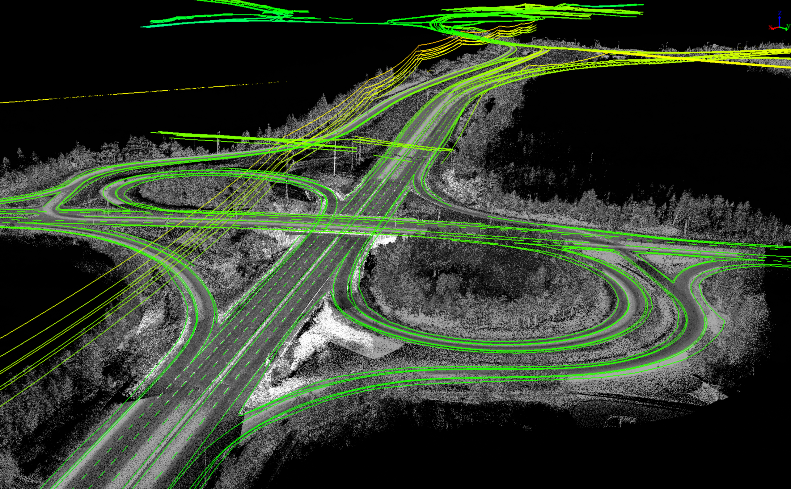
LiDAR With Vectorized Linework
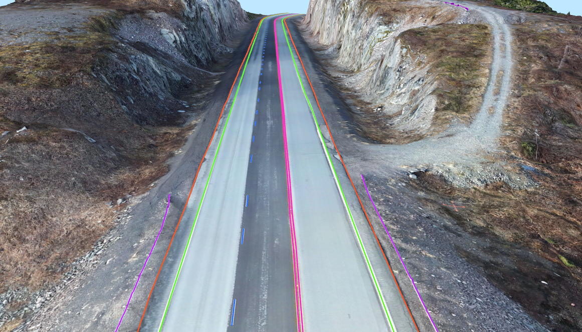
Vectorized Lines on Photogrammetry
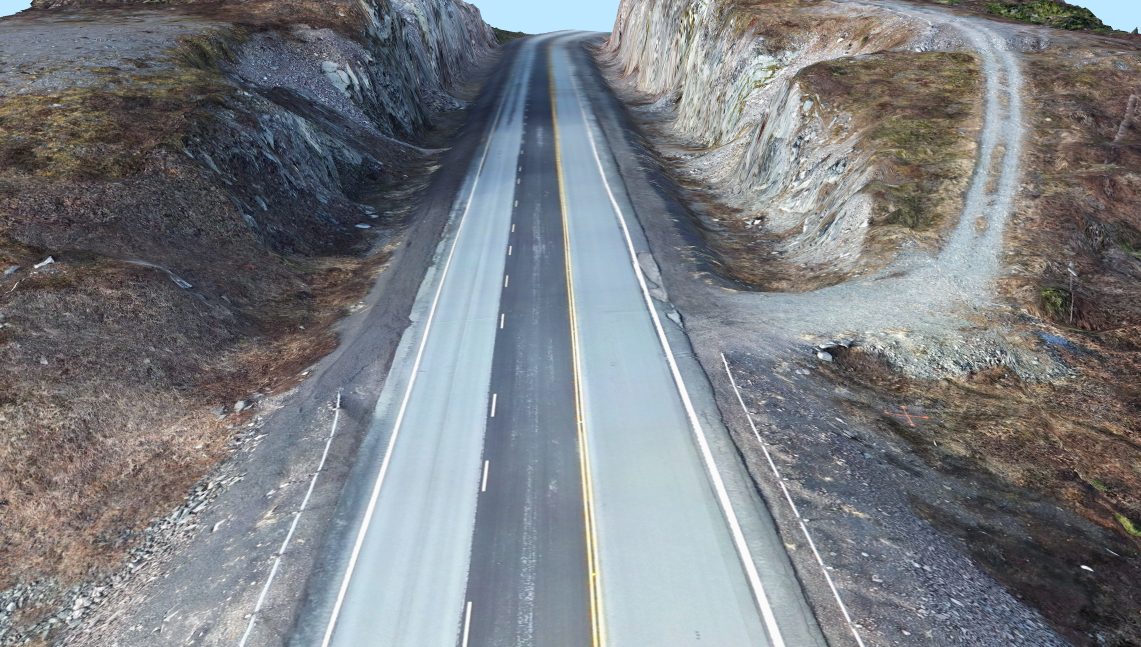
Photogrammetry

Slope failures along highway corridors can create serious safety, environmental, and financial risks. When erosion, instability, or drainage issues emerge, agencies often need to make urgent decisions with limited data, all while managing traffic impacts in challenging site conditions.
RPM helps reduce that uncertainty by delivering high-resolution terrain models with full embankment coverage, allowing engineers to evaluate slope geometry, drainage pathways, and erosion features using a reliable, defensible baseline. Our approach captures detailed information without placing crews on unstable slopes or relying on sparse data from conventional surveys.
RPM’s patent-pending mobile mapping configuration features an extendable LiDAR system that reaches beyond the vehicle’s wheelbase, providing a clear line of sight to downward embankments and backslopes. This design enables detailed capture of roadside terrain that is frequently missed by conventional vehicle-mounted systems or requires time-consuming and higher-risk field surveys.
The result is a clearer understanding of slope conditions and stronger data to support faster, more confident mitigation planning.
How RPM Supports Slope Assessment & Mitigation:
- Detailed slope and embankment surface models, including backslopes and difficult-to-access terrain
- Provides critical data to aid identification of high-risk areas for erosion, scour, or potential failure
- Repeat mapping to monitor change over time and detect emerging trends
- Reliable geometry for geotechnical review and mitigation design
- Improved safety by minimizing on-slope field exposure and traffic-side survey work
- Accurate baselines for remediation, stabilization planning, and documentation

RPM's Patent-Pending Mobile Mapping
Hover over the image to see a center-mounted LiDAR scan vs RPM’s patent-pending extended LiDAR mobile mapping scan.
Hint: Notice the shadows (lack of data) behind the guardrail and on the
embankment due to limitations of centre-mounted systems.

Existing Corridor Mapping FAQ
Welcome to FAQs
Please select a frequently asked question from the menu below.
What is LiDAR?
LiDAR (Light Detection And Ranging) is a way of measuring and mapping the ground and infrastructure using lasers. A sensor sends out thousands of light pulses per second and measures how long they take to bounce back, building a very detailed 3D model of the real world.
What is Mobile Mapping?
Mobile mapping is a data collection method that uses vehicle-mounted LiDAR systems to capture dense, accurate, and continuous 3D data along road corridors. It records roadway surfaces and surrounding features, while traveling at normal driving speeds, producing a detailed model of existing conditions.
How does RPM collect highway corridor data more efficiently?
RPM collects highway corridor data more efficiently using its patent-pending truck-mounted mobile mapping LiDAR system, which captures continuous, corridor-wide existing conditions while driving at normal speeds. This approach eliminates the need for slow, stop-and-start conventional surveying, lane closures and the need for crews working near traffic.
What kinds of highway features can RPM map?
In a single scan RPM can map a wide variety of roadway and infrastructure features. Including but not limited to embankments / ditches, linework, guardrails and power infrastructure.
How does RPM improve on traditional survey shots?
Instead of relying on interpolations between limited survey points, RPM captures dense continuous data in one scan across the corridor, creating a more complete representation of existing conditions.
What if a project needs mapping beyond the roadway itself?
RPM can extend mapping beyond the roadway by integrating aerial LiDAR, photogrammetry, and handheld or backpack LiDAR. This allows adjacent terrain, interchanges, bridges, and other areas outside the line of sight of the mobile mapping system to be captured, ensuring complete project coverage beyond the corridor.
Adding photogrammetry to a project provides much needed visual context for planning and design.
What outputs does RPM deliver, and will they integrate with our workflows?
For highways and transportation projects, RPM delivers bare earth and full-feature point clouds (tiled to client specifications), DEMs, contours, extracted infrastructure features such as linework and embankments, and high resolution orthophotos. All outputs are structured for seamless integration into common GIS and CAD platforms. We align formats and feature requirements upfront to ensure the final deliverables fit directly into your workflows without additional conversion or rework.
Slope & Embankment Mapping FAQ
Welcome to FAQs
Please select a frequently asked question from the menu below.
How does RPM help reduce uncertainty in slope assessment?
RPM’s patent-pending extendable, truck-mounted LiDAR system reaches far beyond the vehicle’s wheelbase, capturing dense, continuous coverage of slopes and embankments; areas that are often incomplete or lack detail when surveyed using traditional methods or standard vehicle-mounted systems.
By collecting more complete data upfront, RPM minimizes the need for interpolation. As a result, final models and derived products are grounded in real measurements rather than estimates, delivering greater accuracy, increased confidence, and more informed decision-making for clients.
Can RPM help identify potential slope hazards?
Yes. RPM provides high-resolution terrain data that enables teams to identify potential slope hazards, including areas at risk of erosion, instability, or failure. Its detailed terrain models also support drainage analysis, helping engineers understand how water moves through the area. By revealing both surface conditions and drainage patterns, RPM equips clients with the insights needed to proactively assess risk and make more informed decisions.
Is RPM able to help monitor slope changes over time?
Yes. RPM can perform repeat data collection to monitor slopes over time, capturing high-quality datasets that enable accurate change detection and trend analysis.
While RPM provides the data and supports identifying where and how conditions are changing, we do not perform engineering analysis to determine why those changes are occurring. This allows clients and their engineering teams to apply their own expertise to interpret the results and make informed decisions.
How does RPM improve safety during slope assessment?
RPM captures data quickly using Mobile Mapping, RPAS-based LiDAR, and photogrammetry, significantly reducing the need for field crews to work on or near hazardous slopes, embankments, or active roadways. By operating from within the vehicle or at a safe distance, RPM minimizes exposure to unstable terrain and traffic while eliminating the need for lane closures.