

Highway agencies are responsible for managing extensive networks of roads, bridges, culverts, and roadside assets, often while maintaining aging infrastructure and planning upgrades that must be backed by defensible data. Yet the information needed to support those decisions is frequently fragmented or outdated. Records and as-builts may be incomplete, and baseline data inconsistent. The result is greater uncertainty during planning and scoping, additional site visits to fill information gaps, and unexpected issues that emerge later during design or construction.
RPM creates accurate, high-fidelity digital infrastructure models that turn corridor assets into clear, actionable deliverables with a reliable corridor-wide baseline. The result is more confident and efficient maintenance planning, clearer prioritization, and faster upgrade scoping captured quickly with reduced field exposure and minimal lane disruption.
RPM can support:
- 3D modeling of roads, bridges, culverts, drainage features, and roadside assets
- Creating current digital baselines that integrate into asset management systems
- Rehabilitation, expansion, and capital planning with dependable existing-conditions data
- Reducing rework caused by missing, outdated, or unverified asset information
- Deliverables compatible with CAD, GIS, and BIM workflows
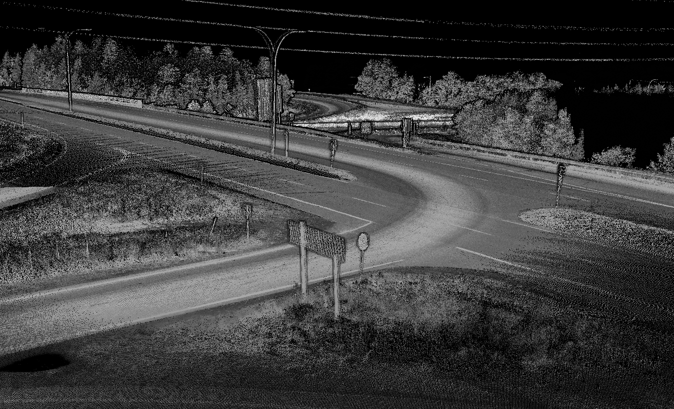
Intersection
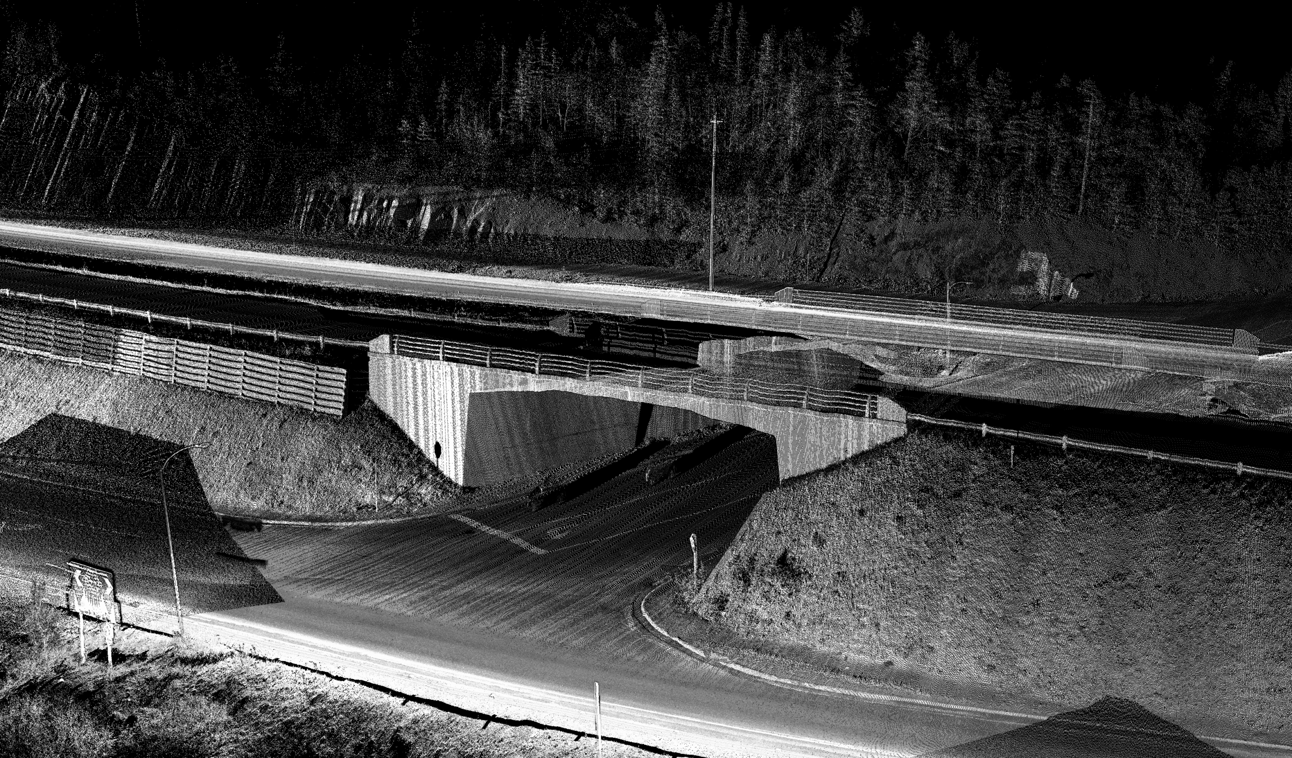
Overpass
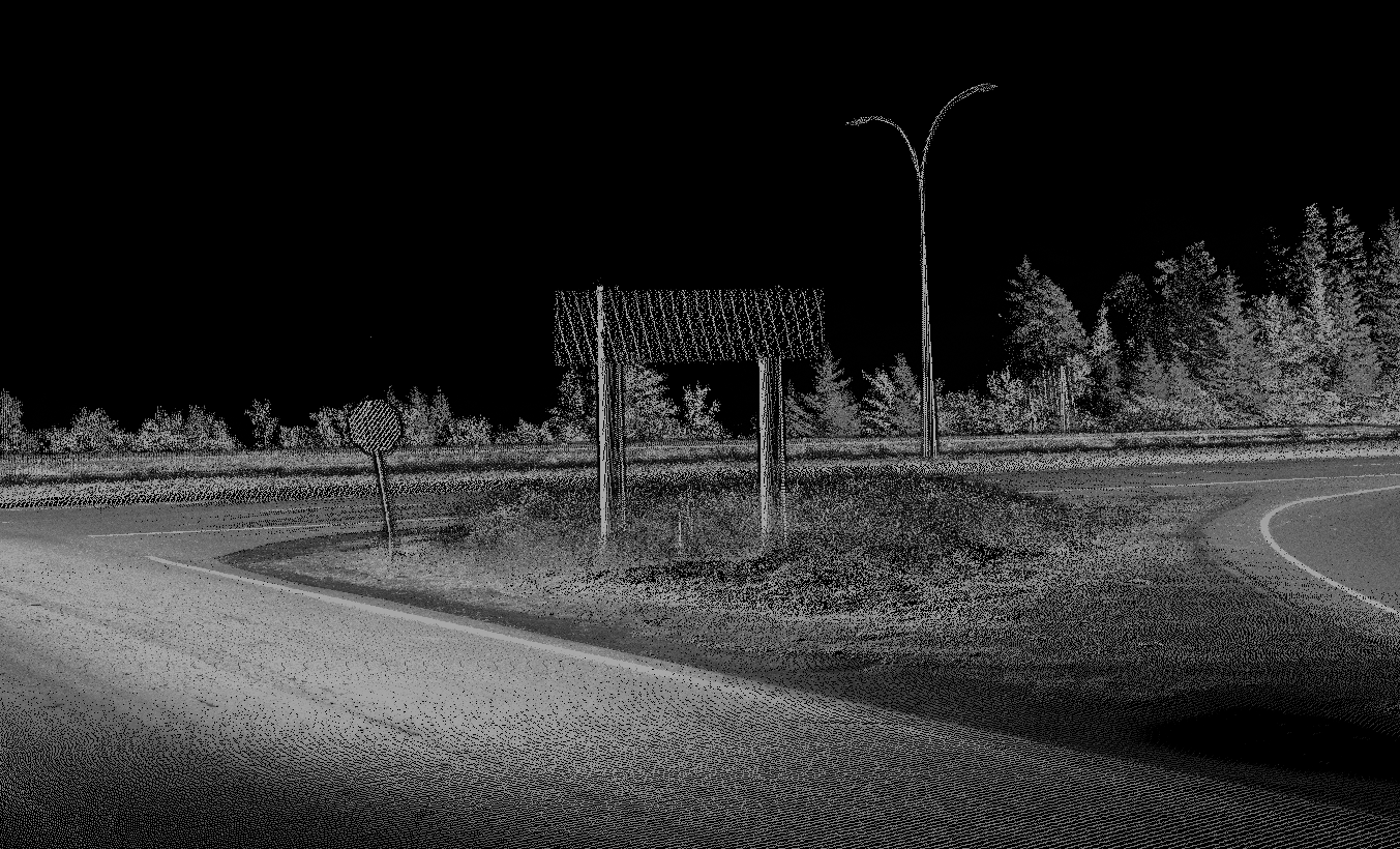
Signage
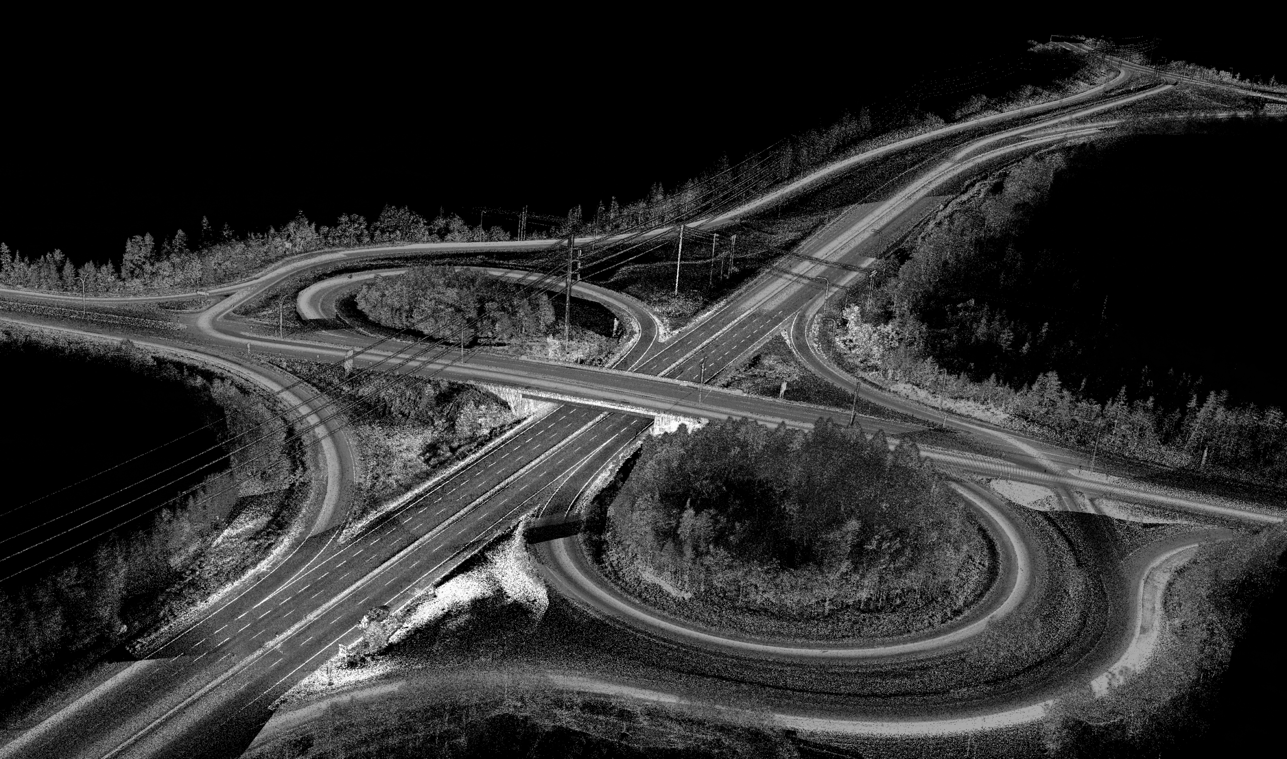
Cloverleaf

FAQ
Welcome to FAQs
Please select a frequently asked question from the menu below.
What is the main value RPM provides for highway asset management?
RPM is able to collect, process and provide a complete view of highway asset data quickly, and accurately. By utilizing mobile mapping, we are reducing the need for costly manual surveys by gathering a dataset that contains the roadway and all present features in a single scan. This allows clients to get what they need, when they need it.
What kinds of assets can RPM model?
RPM can provide 3D datasets of roads, bridges, culverts, drainage features, and roadside assets to support a clearer understanding of corridor conditions.
How does RPM improve maintenance planning?
By creating a current and reliable baseline, RPM allows agencies to assess assets more confidently, prioritize maintenance needs more clearly, and make planning decisions with better supporting data.
How is RPM’s approach safer and less disruptive?
RPM captures data quickly using Mobile Mapping, RPAS-based LiDAR and photogrammetry, significantly reducing the need for field crews to work on or near active roadways. RPM can operate from within the vehicle or at a safe distance, minimizing exposure to traffic while eliminating lane closures. This allows clients to receive the data they need with fewer disruptions to both workers and the traveling public.
What outputs does RPM deliver, and will they integrate with our workflows?
For highways and transportation projects, RPM delivers bare earth and full-feature point clouds (tiled to client specifications), DEMs, contours, extracted infrastructure features such as linework and embankments, and high resolution orthophotos. All outputs are structured for seamless integration into common GIS and CAD platforms. We align formats and feature requirements upfront to ensure the final deliverables fit directly into your workflows without additional conversion or rework.