

Municipal infrastructure is constantly changing, yet many towns rely on mapping that is incomplete, outdated, or difficult to maintain. When infrastructure locations and roadside assets are not clearly documented, planning projects, coordinating crews, and managing infrastructure becomes slower, more uncertain and costly.
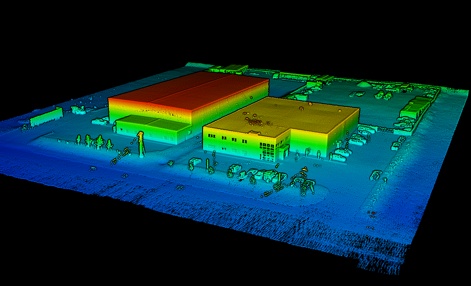
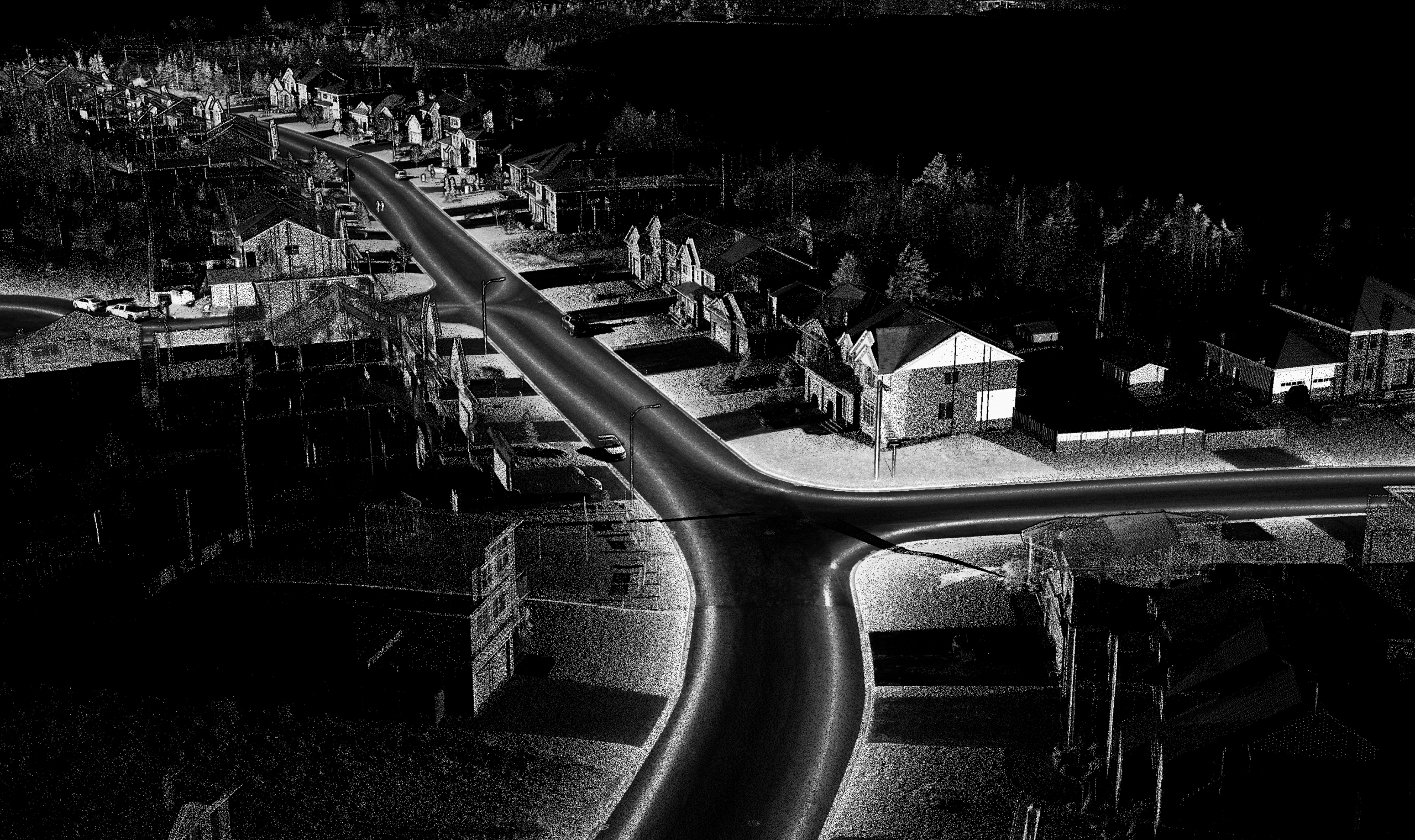
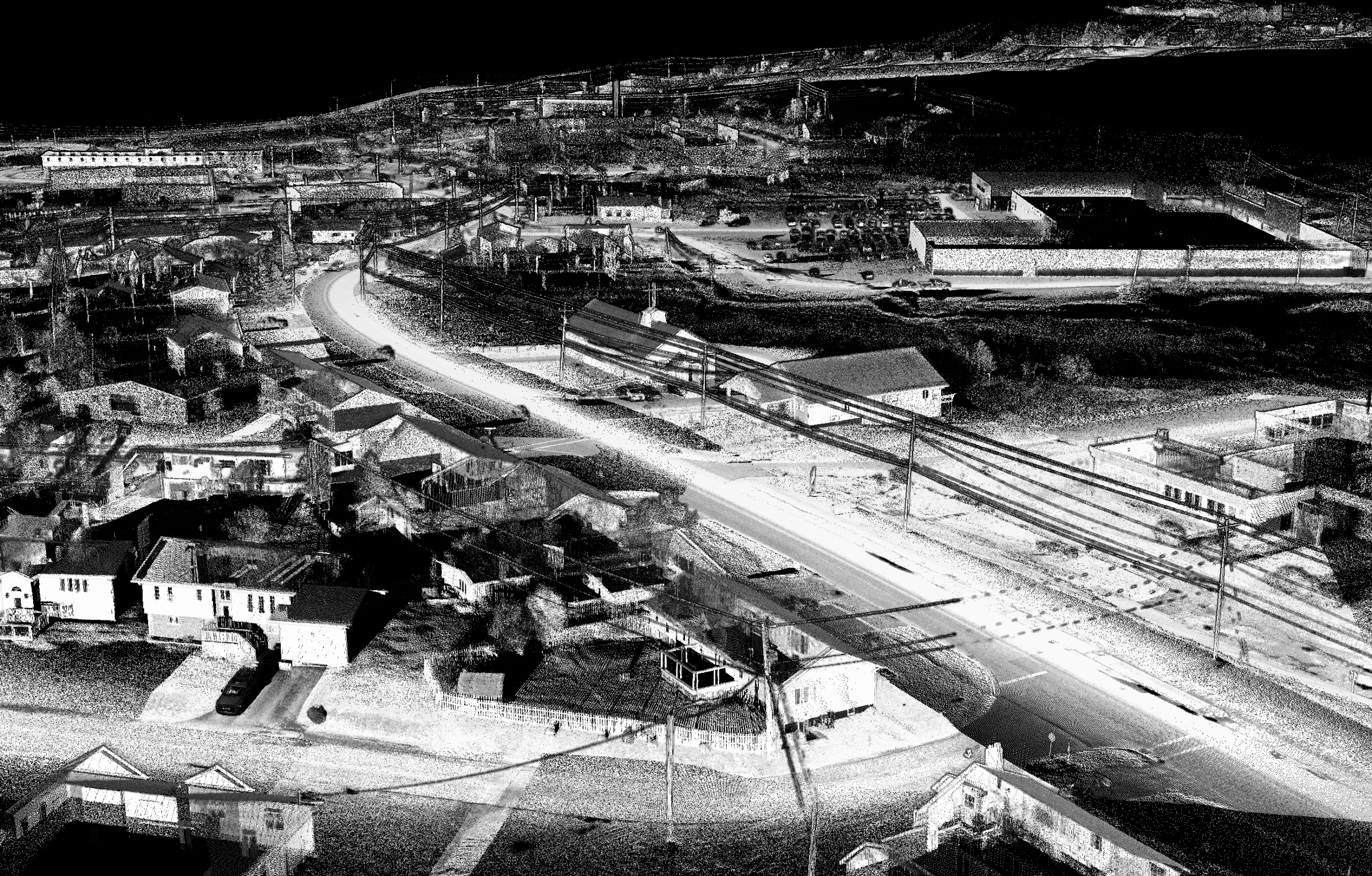
RPM helps municipalities build a clearer picture of their infrastructure using mobile mapping and aerial LiDAR technologies. Vehicle-mounted LiDAR systems rapidly scan street-level assets, capturing dense spatial data that allows RPM to extract accurate 3D linework and map roadside assets with precise locations. This information supports infrastructure inventories, engineering planning, and GIS-based asset management.
For municipalities looking to improve their water distribution systems, these datasets provide reliable spatial context for hydrants, valves, and related infrastructure along municipal road networks.
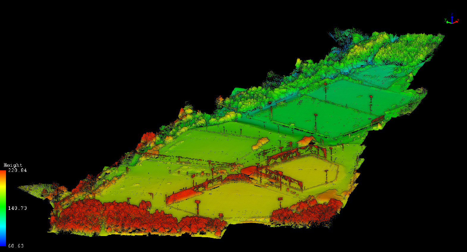
To complement street-level mapping, aerial LiDAR surveys capture municipality-wide terrain and surface data, supporting drainage analysis, elevation modeling, and infrastructure and emergency planning. High-resolution aerial imagery and photogrammetry products can also be generated alongside these datasets, providing clear visual context for planning, communication, and GIS integration.
How RPM Supports Infrastructure and Asset Mapping
-
Mobile mapping LiDAR surveys to capture detailed street-level data
-
Extraction of 3D linework and mapped infrastructure assets with accurate spatial positioning
-
Mapping of infrastructure that supports water distribution systems, including hydrants and valves
-
Aerial LiDAR acquisition to generate terrain models and elevation data for drainage and infrastructure planning
-
High-resolution orthophotos and imagery to provide visual context alongside LiDAR data
Start With the Data You Need
Infrastructure mapping projects can be tailored to municipal priorities. Some municipalities begin with mobile mapping of priority corridors to improve infrastructure inventories, while others start with aerial LiDAR to establish a municipality-wide terrain baseline.
These datasets can be used independently for planning and engineering or integrated into a Municipal GIS to support long-term infrastructure management.
Buildings
Parks
New Development Modeling
Full Community Scans
")
FAQ
Welcome to FAQs
Please select a frequently asked question from the menu below.
What exactly is LiDAR?
LiDAR (Light Detection And Ranging) is a way of measuring and mapping the ground and infrastructure using lasers. A sensor sends out thousands of light pulses per second and measures how long they take to bounce back, building a very detailed 3D model of the real world.
In simple terms, it’s like giving municipalities a fast, accurate way to “see” and map roads, terrain, and infrastructure without ever having to leave your office.
How does RPM collect asset data?
RPM collects asset data using three primary methods, depending on project needs:
Mobile Mapping – A truck-mounted LiDAR system captures detailed roadway and municipal asset data at posted driving speeds, minimizing disruption.
Aerial LiDAR – Provides fast, municipality-wide topographic coverage, supporting planning and design for larger infrastructure projects. These methods can be carried out via helicopter or drone depending on project scope.
Aerial Photogrammetry – High-resolution imagery adds visual context, helping municipalities understand surface conditions, existing infrastructure, and changes over time.
RPM also offers additional collection methods, including backpackable, handheld, and tripod-based systems, to support projects in areas that are GNSS denied such as inside buildings, treatment plants etc.
Whats so special about RPM’s Mobile Mapping?
Mobile Mapping collects data that is thousands of times denser, exponentially faster, and significantly safer than traditional methods. In just one scan, our system collects ultra dense point clouds that can be used to extract a variety of assets such as road lines, ditches, power lines, hydrants etc. This enables municipalities to act with confidence knowing they are working with a baseline of detailed, accurate data.
Why is it important for municipalities to have accurate, up-to-date asset data?
Without accurate, up-to-date data, municipalities often need to gather infrastructure information on a project-by-project basis. This adds time, cost, and uncertainty.
Having reliable asset data in place means projects can move forward with confidence, using a consistent foundation for planning, design, and construction.
How does accurate asset data improve efficiency and reduce risk in municipal projects?
Accurate asset data supports everything from daily operations to large-scale project planning. With reliable location information, crews can find and work on infrastructure more efficiently, reducing time in the field.
For planning and design, having dense and highly detailed topographic and asset data lowers the need for repeated surveys and improves design accuracy. This leads to better material estimates, fewer surprises during construction, and ultimately reduced costs, delays, and rework.
How do RPM’s data collection methods improve safety compared to traditional surveying?
With traditional survey methods such as GNSS and Total Stations, one or more field crews on the ground are required. RPM specializes in remote sensing, performing data collection with cutting edge technology, which allows field crews to operate from a safe location while capturing accurate, high quality data.