

Airports rely on accurate, up-to-date spatial data to stay compliant, plan projects, and keep operations running smoothly, but many teams are stuck working with a mix of outdated drawings, inconsistent basemaps, and data that doesn’t reflect what’s actually on site today.
RPM helps airports move faster by quickly capturing reliable, defensible geospatial data that supports engineering, GIS, and compliance workflows without the delays and challenges of traditional survey methods. Using our array of cutting edge mapping technologies RPM is able to capture highly accurate and ultra-dense geospatial data on above/below ground and indoor infrastructure. This provides clients with reliable baselines that reduce repeat field verification, simplify coordination, and keep capital work and day-to-day decisions moving.
Our approach is tailored for active airport environments, enabling data capture without interrupting operations (including overnight when required). It enhances safety by minimizing or eliminating the need for personnel to enter high-risk areas such as runways. By leveraging truck-based mobile mapping and RPAS, we replace larger ground crews with a streamlined team that collects remotely sensed data faster, more safely, and with significantly less disruption.
The result is a dependable, current baseline that reduces the need for repeat field checks, simplifies coordination, and helps keep both capital projects and day-to-day decisions moving forward.
Above-Ground Mapping
Cutting-edge technologies such as mobile mapping, airborne LiDAR, and handheld or backpack systems enable RPM to efficiently capture complex above-ground assets. Our mobile mapping platforms allow for rapid collection of above ground infrastructure, from parking lots to runways, completing in days what traditionally takes weeks. In GNSS-denied areas, tripod and backpack LiDAR systems make it possible to safely and accurately capture indoor and hard-to-access environments. Together, these approaches deliver fast, comprehensive data acquisition while minimizing disruption to active airport operations
Below-Ground Mapping
Advanced geophysical methods, including RF-based electromagnetic locating tools and magnetometry, enable RPM to accurately map complex subsurface infrastructure without intrusive investigation. These approaches allow us to efficiently identify and trace buried utilities, even in areas where records are incomplete or unreliable, reducing uncertainty before ground is broken. In select environments (such as maintenance tunnels or entryways) tripod, backpack, or drone based GNSS-denied LiDAR systems support the capture of accessible subsurface features. Together, these methods provide a clearer understanding of underground conditions while minimizing disruption to airport operations and reducing risk during excavation and construction.
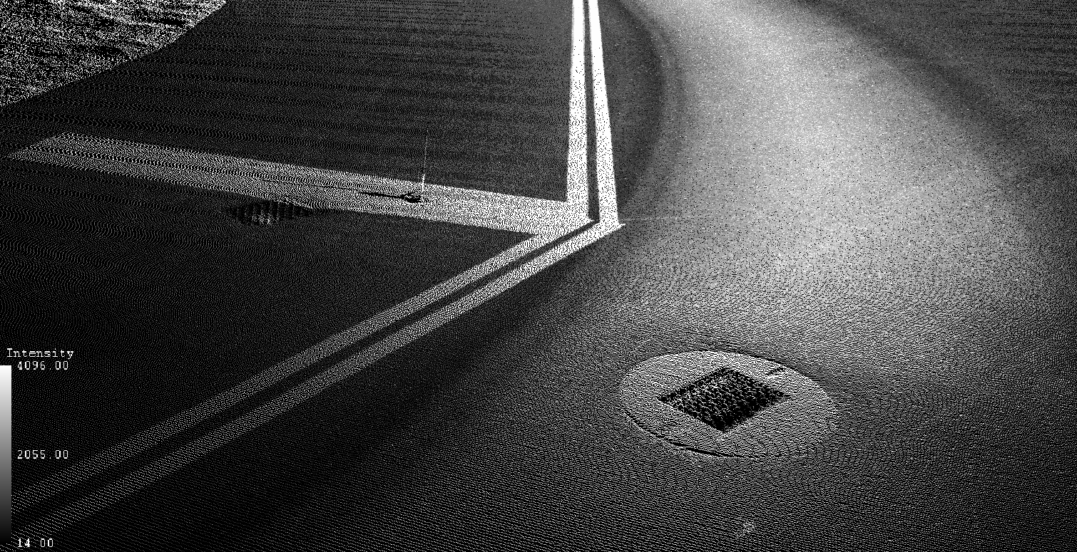
Access Points & Catch Basins
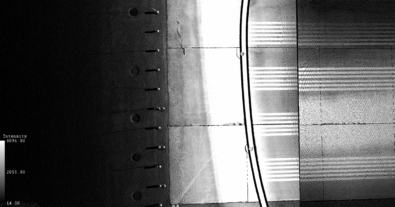
Runway Lighting
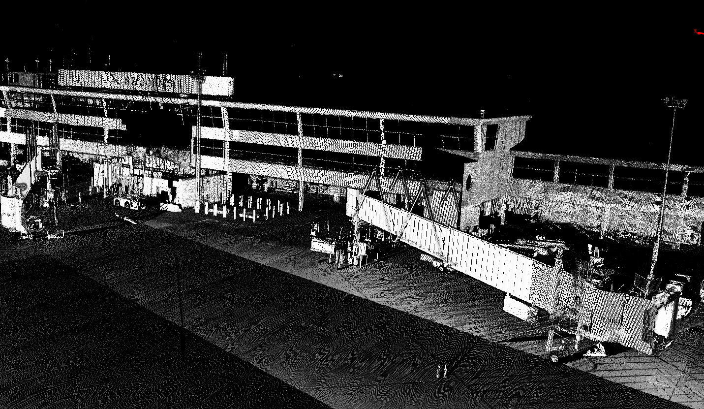
Airside Infrastructures

Pavement Distress

FAQ
Welcome to FAQs
Please select a frequently asked question from the menu below.
How does RPM help reduce underground utility risk?
RPM locates and maps subsurface infrastructure before construction or excavation starts, helping airport teams reduce uncertainty, avoid strikes, and plan work more confidently.
What types of underground infrastructure can RPM map?
RPM employs multiple technologies capable of mapping underground infrastructure. Provided the infrastructure to be located is conductive (i.e. copper), magnetic (i.e. iron/steel pipe), or has tracer wires, RPM can map it.
Does RPM use invasive methods to locate utilities?
No. RPM uses non-invasive locating methods to confirm utility locations and gather the information needed without unnecessary disruption.
Can RPM help update outdated as-builts?
Yes. RPM helps confirm and update legacy as-builts so airport teams can work from more accurate subsurface information before construction begins.
Does RPM support GIS-based asset management?
Yes. RPM can digitize subsurface infrastructure into GIS to support long-term asset tracking, maintenance planning, and future project coordination.